EstuaryWatch Data Portal
Estuary event details
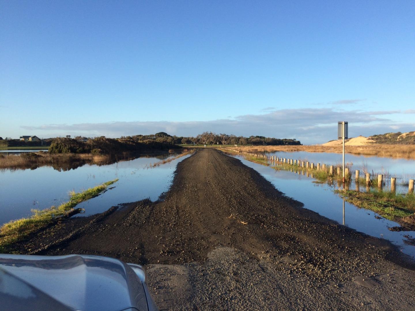
| Estuary | Powlett River Estuary |
|---|---|
| Region | West Gippsland CMA |
| Event type | Water level |
| Date and time | 19 June 2018 08:30am |
| Description |
Over the previous few years the Bass Coast Shire Council has incrementally increased the height of the Mouth of the Powlett Road. During this years closure approximately 1/3 of the road was inundated at 2.375m AHD (see image attached). Even at 2.41m AHD later in the day prior to the artificial estuary opening the road was still useable, with water covering a fraction more than 1/3 of the road. |

All content, files, data and images provided by the EstuaryWatch Data Portal and Gallery are subject to a Creative Commons Attribution License
Content is made available to be used in any way, and should always attribute EstuaryWatch and www.estuarywatch.org.au