EstuaryWatch Data Portal
GMC Gellibrand River Estuary Mouth Observation Site
12 May 2018
Observation details
Overview
| Estuary | Gellibrand River Estuary |
|---|---|
| Site | Gellibrand River Estuary Mouth Observation Site |
| Observation ID | #12046 |
| Date and Time | Saturday 12th May 2018 11:15am |
| Approved | Approved |
Notes
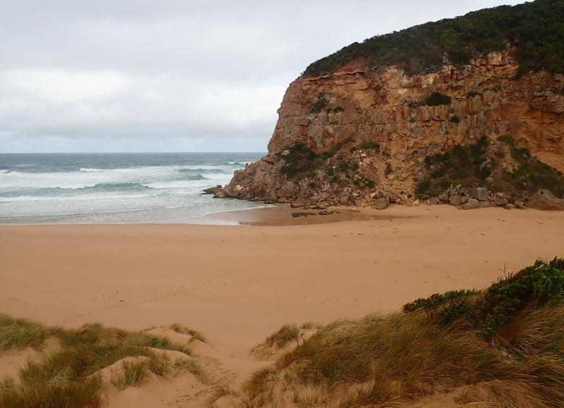
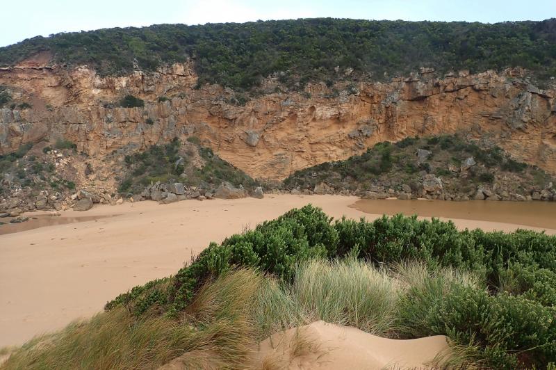
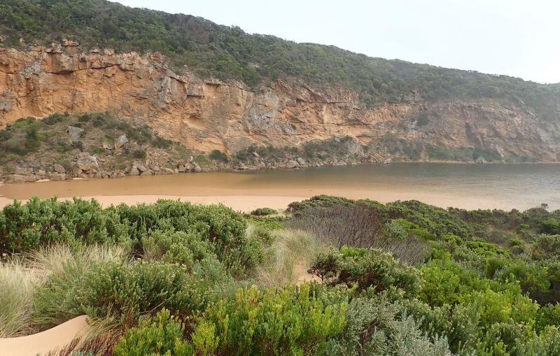
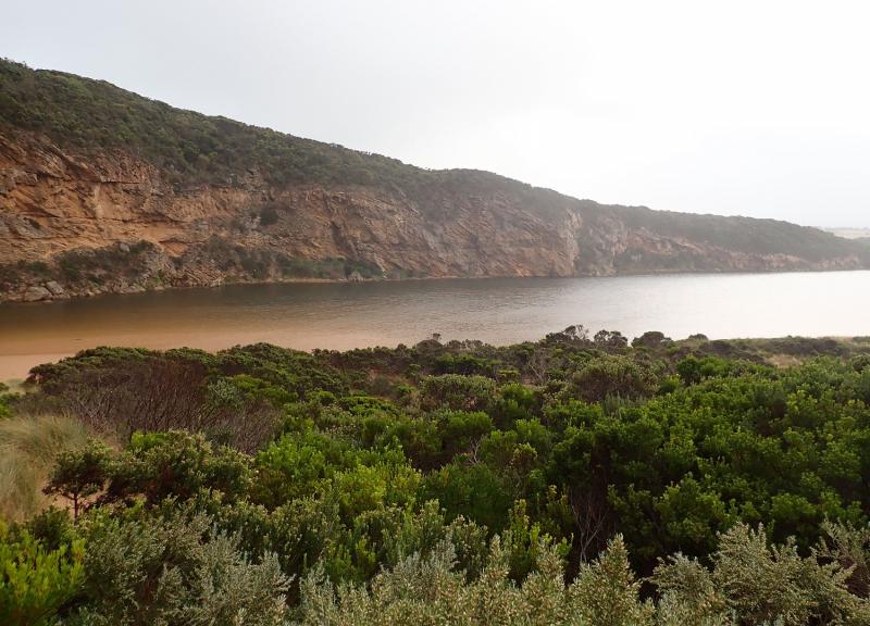
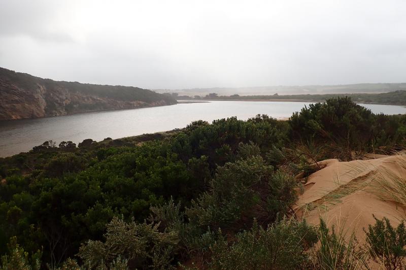
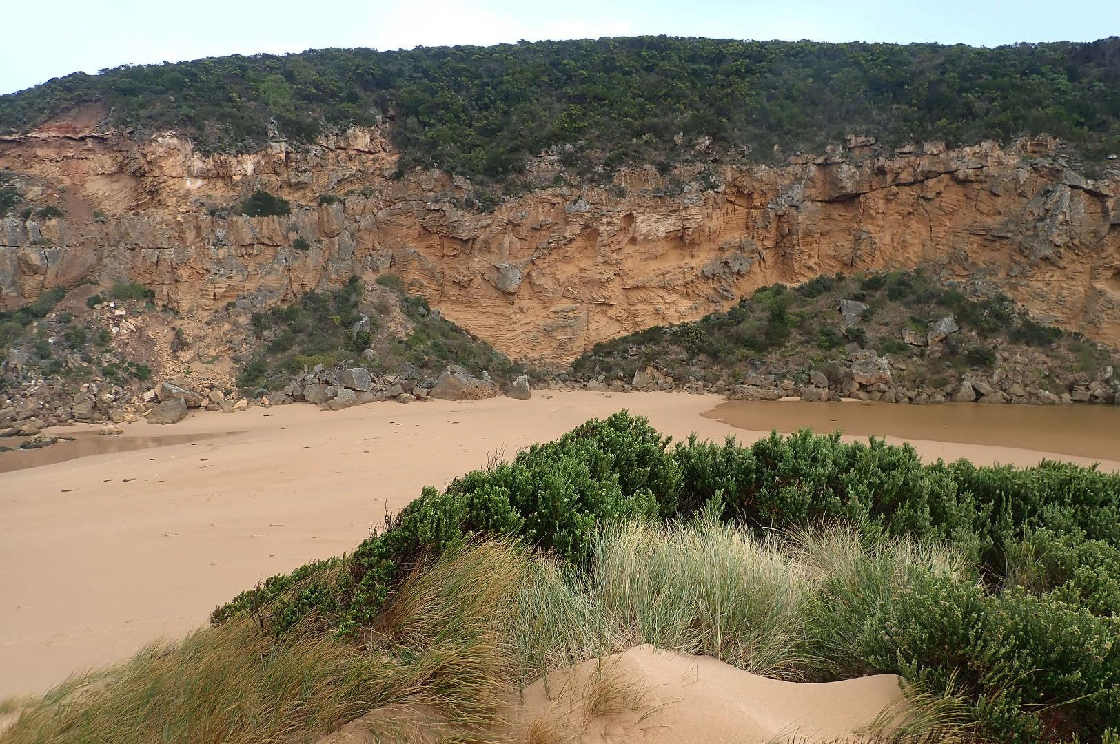
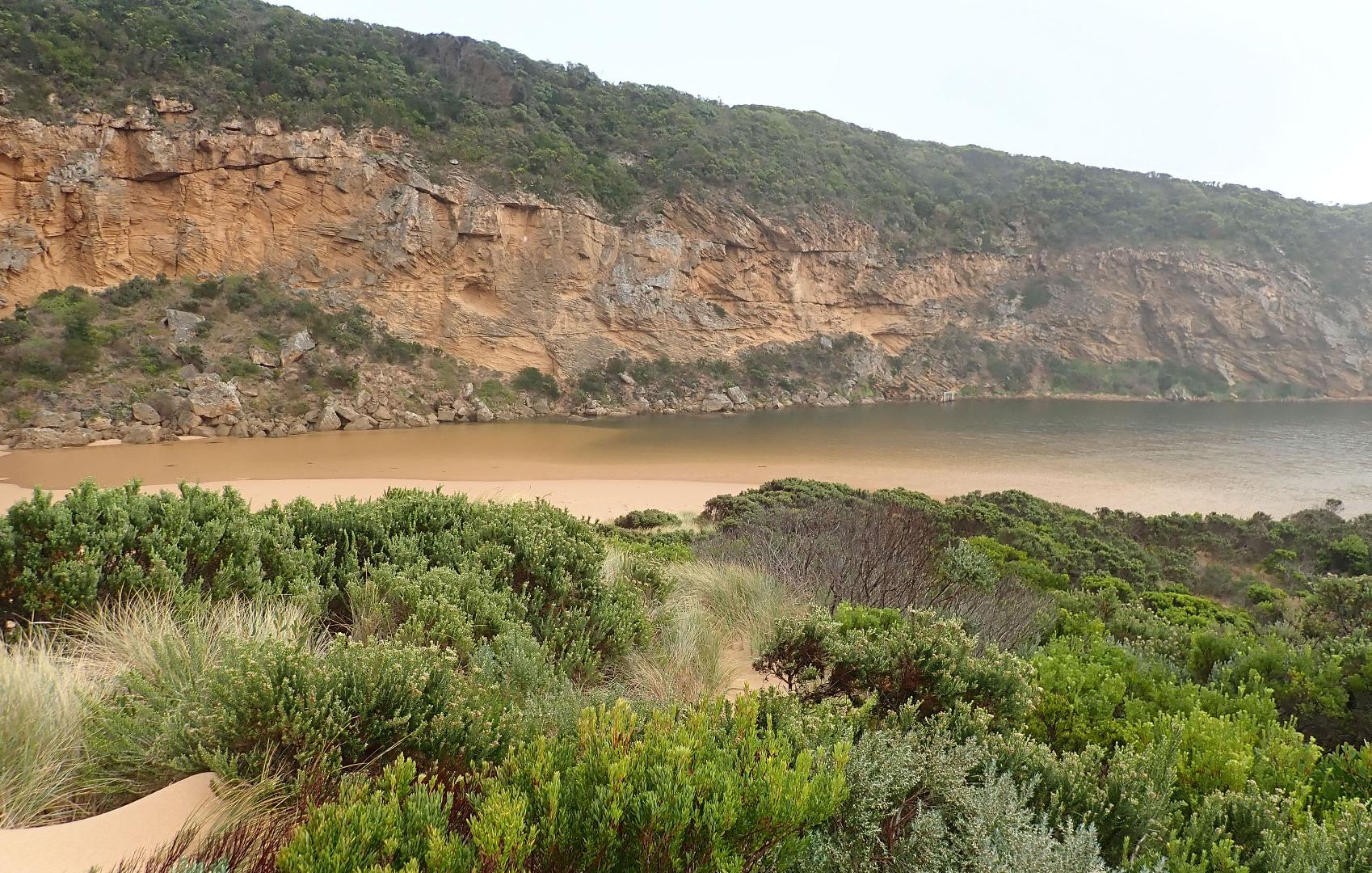
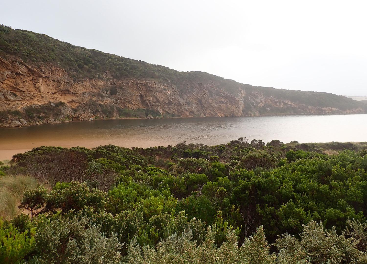
Observations made close to high tide. Mouth barred after gale force south winds & high seas on 11-05-2018. Berm is very low at entrance as 3 rocks are well exposed but rises high about mid channel & extends north under shallow water well into estuary. Wind & waves have scoured out east end of beach which is now lowest part. The highest part occurs just east of the entrance which is wide with some longshore drift visible
Wind has reshaped the dunes depositing large amounts of sand over vegetation and removing it from other areas. Rock falls have increased on south & east sides of Pt. Ronald
Mouth Observation
| Mouth state | Closed |
|---|---|
| Previous | C O O O O O O O O O O O O O O O O O O O O O O O O O O O P C C C C C C C O O O O C C C C C C C C C O O O O O |
| Flow Present? | No |
| Previous | N Y Y Y N Y Y Y Y Y Y Y Y Y Y Y Y Y Y Y Y Y Y Y Y Y Y Y N N N N N N N N Y Y Y Y N N N N N N N N N Y Y Y Y Y |
| Flow Direction | N/A |
| Previous | N O O O N O O O O O O O O O O O O O O O O O O O O O O O N N N N N N N N O I O O N N N N N N N N N O O O O O |
| Above Sea | Above Estuary | |
|---|---|---|
| Berm Height (m) | ||
| Berm Length (m) |
Physical Condition
| Current | Mode | |
|---|---|---|
| Wind Direction | South | |
| Beaufort Scale | Strong breeze | |
| Sea State | Rough |


All content, files, data and images provided by the EstuaryWatch Data Portal and Gallery are subject to a Creative Commons Attribution License
Content is made available to be used in any way, and should always attribute EstuaryWatch and www.estuarywatch.org.au