EstuaryWatch Data Portal
GMC Gellibrand River Estuary Mouth Observation Site
13 February 2010
Observation details
Overview
| Estuary | Gellibrand River Estuary |
|---|---|
| Site | Gellibrand River Estuary Mouth Observation Site |
| Observation ID | #3166 |
| Date and Time | Saturday 13th February 2010 08:50am |
| Approved | Approved |
Notes
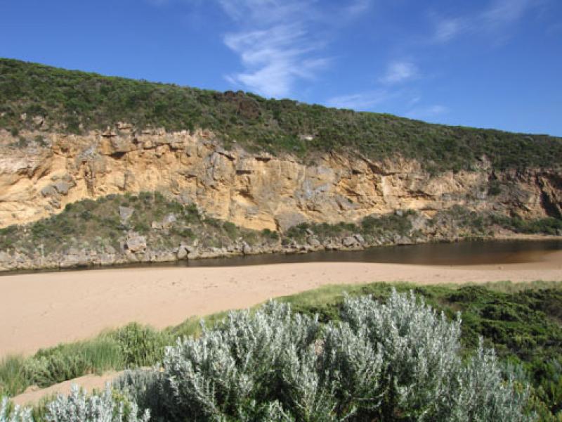
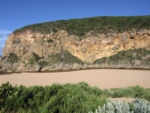
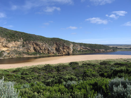
1.Rainfall has increased out flow slightly - discharge around mouth and to west (along in front of cliffs). Sand visiable in waves in that area
2. Sand is still building up infront of the rocks, flow is alongside of cliff . Longshore drift continues to deposit sand in channel
3.Rocks are exposed at east end of beach. Steep front to beach, highest area is mid beach with a slope down to the channel (west) behind rocks.
Mouth Observation
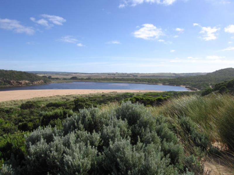
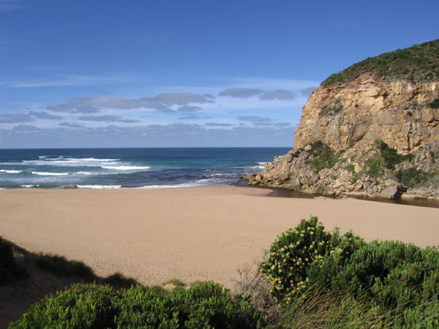
| Mouth state | Open |
|---|---|
| Previous | C C C C C C O C O O O O O O P O O O O P P P C P P O O O O P P O O O O O O C O O O O O O O O O O O O O O O O O O O O O O O O O O O O O O O O O O O O O O P O |
| Flow Present? | Yes |
| Previous | N N N N N N Y N Y Y Y Y Y Y Y Y Y Y Y Y Y Y N Y Y Y Y Y Y Y Y Y Y Y Y Y Y Y Y Y Y Y Y Y Y Y Y Y Y Y Y Y Y Y Y Y Y Y Y Y Y Y Y Y Y Y Y Y Y Y Y Y Y Y Y Y Y Y |
| Flow Direction | Out |
| Previous | N N N N N N O N O O O O O O I O O O O O I N I I O O O I I O O O O I I O I O O O O O O O O O O O O O O O O O O O O O O O O O O O O O O O O O O O O O O O |
| Above Sea | Above Estuary | |
|---|---|---|
| Berm Height (m) | ||
| Berm Length (m) |
Physical Condition
| Current | Mode | |
|---|---|---|
| Wind Direction | South | South-East |
| Beaufort Scale | Moderate breeze | Moderate breeze |
| Sea State | Moderate | Slight |


All content, files, data and images provided by the EstuaryWatch Data Portal and Gallery are subject to a Creative Commons Attribution License
Content is made available to be used in any way, and should always attribute EstuaryWatch and www.estuarywatch.org.au