EstuaryWatch Data Portal
GMC Gellibrand River Estuary Mouth Observation Site
16 July 2010
Observation details
Overview
| Estuary | Gellibrand River Estuary |
|---|---|
| Site | Gellibrand River Estuary Mouth Observation Site |
| Observation ID | #3941 |
| Date and Time | Friday 16th July 2010 11:05am |
| Approved | Approved |
Notes
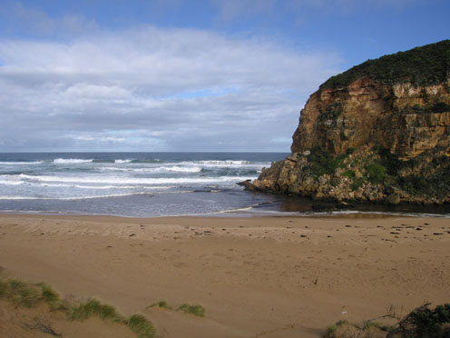
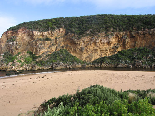
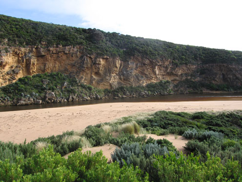
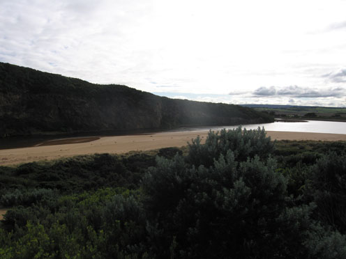
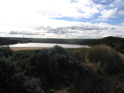
1. Stronger outflow due to recent rainfall.Increased turbidity causing a dark discharge to about 2/3ds along beach from entrance.
2. Some waves entering into estuary.
Waves in all directions at mouth with more sand from long shore drift entering channel
3.Steep cliffs of sand have formed along mid beach and last hi tide has reached nearly up to the dunes
4. Salmon being caught on beach
Mouth Observation
| Mouth state | Open |
|---|---|
| Previous | O O O O O O O O O O O O O O O O O O O O O O O O O O O O O O O O O O O P O O O O O O O O O O O O O O P O O O O O O P O O O O O |
| Flow Present? | Yes |
| Previous | Y Y Y Y Y Y Y Y Y Y Y Y Y Y Y Y Y Y Y Y Y Y Y Y Y Y Y Y Y Y Y Y Y Y Y Y Y Y Y Y Y Y Y Y Y Y Y Y Y Y Y Y Y Y Y Y Y Y Y Y Y Y Y |
| Flow Direction | Out |
| Previous | O O O O O O O O O O O O O O O O O O O O O O O O O O O O O O O O O O O O O O O O O O O O I O O I O O I O O O O I O I O I O O I |
| Above Sea | Above Estuary | |
|---|---|---|
| Berm Height (m) | ||
| Berm Length (m) |
Physical Condition
| Current | Mode | |
|---|---|---|
| Wind Direction | North | |
| Beaufort Scale | Fresh breeze | |
| Sea State | Moderate |


All content, files, data and images provided by the EstuaryWatch Data Portal and Gallery are subject to a Creative Commons Attribution License
Content is made available to be used in any way, and should always attribute EstuaryWatch and www.estuarywatch.org.au